A history of navigation

2019-10-30_Anker-Navigation_01

From atlas to MBUX.

This article was originally published in the Daimler blog.

Unfold it on your lap, give directions to the driver, get lost, get into an argument. Repeat. Reading maps used to be a familiar way for us humans to get an often unnerving handle on our environment. To be fair, the game has constantly improved: from carrying a thick road atlas to printing turn-by-turn directions to the first simple arrow appearing in a car’s head unit to today’s always-on maps that tap into and tie together myriad online data sources.

8 min reading time

by Steffen Tacke, Responsible for the worldwide development of MBUX navigation systems for Mercedes-Benz passenger cars
published on October 28, 2019

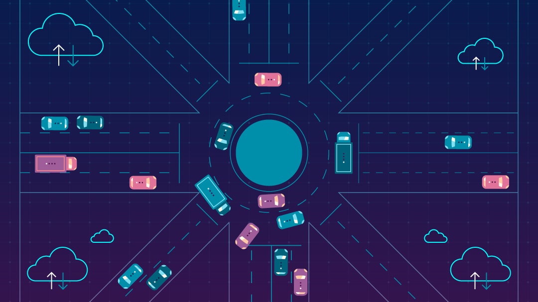
But the biggest changes still lie ahead as maps are becoming context aware. They will soon know my calendar and can pull up nearby restaurants, they can highlight important landmarks such as 3D icons, fetch gas prices and much more. That’s just the first kilometer on a much longer, more exciting journey that will take us into the age of autonomous driving. New map formats are emerging that are not even designed to be read by humans but by connected and autonomous vehicles.

It will be another historic milestone. While ancient maps filled unknown spaces with fantastic imagery of wild animals, monsters and all kinds of embellishments, humans of the Enlightenment were for the first time courageous enough to leave white spaces in maps, as an inducement to go out and explore.

How did we get here?

Navigation has made significant progress as the evolution of maps for Mercedes-Benz vehicles shows. The first APS, short for Auto-Pilot System, was introduced in 1995, followed by the COMAND navigation interface in 1998 and its online version in 2011 that included live traffic information and MB Apps.

From 1995, the Auto Pilot System APS was optionally available in Mercedes-Benz S-Class saloons and Coupés of the model series 140 (1991 to 1998).Asian markets such as China also prefer their own providers.

Connectivity improved even more with the release of COMAND Online, together with Mercedes me in 2014. Users could send destinations from their smartphone straight to the vehicle and place emergency calls. 2016 saw the release of so-called SNAP online services in the E Class, including gas prices, local weather, parking garage availability and vehicle to infrastructure or Car-2-X communications to warn of local hazards.

The most recent innovation by Daimler called MBUX (short for Mercedes-Benz user experience) was unveiled in the A Class at the Consumer Electronics Show (CES) in 2018. Navigation is now powered by artificial intelligence plus augmented reality to display rich information right before our eyes, and it can be controlled with the user’s voice simply by saying “Hey Mercedes!”

Imagine what a service such as what3words can do in combination with an intelligent vehicle with a voice interface. The London-based startup has divided the world into 3×3 meter tiles and assigned each of these 57 trillion quadrants a unique combination of three words like “table.chair.lamp.” The result: nobody needs to memorize an unfamiliar address and you can easily navigate to a place that doesn’t even have an official address.

Always on and always reliable

The technology running behind the head unit (and increasingly in the cloud) has come a long way. Old navigation systems relied on up to nine CDs, then DVDs and SD cards with more and more storage capacity. A state-of-the-art SD card can hold up to 70 Gigabytes of data on board. Modern systems need more fresh information, though. They query a multitude of online sources and suck down over-the-air updates.

Key input comes from players such as European location services companies HERE and TomTom, plus information platforms such as Yelp and TripAdvisor. Since these services live in the cloud, navigation systems have become endlessly flexible and expandable. Take road conditions. The latest on traffic and construction sites is streamed to a vehicle every two minutes.

Navigation data that’s always available and reliable — that’s what sets in-car navigation by an OEM like Daimler apart from mapping apps on smartphones. Drivers, after all, need to be confident that their navigation system won’t leave them stranded, even when there’s no cell phone coverage.

Getting the relevant information into every vehicle poses its own challenges. First off, navigation systems need good and reliable localization depending on where in the world a car is. Asian markets such as China, Japan or Korea, where addresses are structured around points of interest more than fixed house numbers, prefer their own map providers. In some cases, they require governmental sign-off for new releases or cannot be taken outside the country. Europe and the U.S. also have their own providers whose base set of navigation data is loaded onto a vehicle’s head unit before it ships.

Navigation: Asian markets such as China also prefer their own providers.

The size and density of a country, region or province and the rate of urban change determines how many updates are delivered and how. On average, drivers today regularly receive between 250 and 350 Megabytes of fresh data regularly, either over the air or via USB stick, as part of their infotainment package. The denser a region and the more changes it accumulates, the more data it requires. That’s why updates for larger countries are usually broken up into smaller pieces. The map of Beijing, for instance, with its 24 million people, is as large as that for an entire European country.

Navigation has made significant progress.

And there’s another key factor instigating how we build maps for the future. As more and more cars with advanced driver assistance systems (ADAS) or truly autonomous capabilities hit the road, maps need to become machine readable. Take the new maps by HERE, a location technology platform jointly owned by Daimler, BMW, Audi and several other companies. They form the basis for providing an “electronic horizon” that gives vehicles fine-grained and forward-looking information on details such as road geometry, lanes, curvatures and slopes ahead of time, as well as the location and dimension of curbs etc.

This precision to the centimeter allows autonomous driving systems to localize, plan and navigate a route down to the exact lane in which they are driving. The standard GPS that humans have become used to is not detailed enough, and those new types of data-stuffed maps are not even intended for humans. Furthermore, tomorrow’s maps require deep integration with the vehicle and its components down to the drive train. Experts expect such high-definition or HD maps to be available for urban environments between 2020 and 2025.

Maps have always inspired the human imagination.

When computers drive, what will humans see?

Which raises a fundamental question: What will humans see, be it as drivers or — increasingly — as passengers in an autonomous vehicle?

Humans, as it turns out, stand to gain a lot from the future of navigation since it will convert our journeys into more of an experience, with a focus on comfort and convenience. New systems can merge high-level ADAS visualizations with mapping and navigation, presenting an HD mixed reality guidance that blends elements of augmented and virtual reality with the real world outside the windshield. Once the car takes care of the route, we will have our eyes and minds free to focus on things such as nearby points of interest that can come to life or personal information that is relevant right there, right now.

Which means that with tomorrow’s navigation, neither you nor your vehicle will get lost anymore. Even better, you also won’t get bored as we’re busy filling the last white spots in the world with relevant and reliable information.

Steffen Tacke

Steffen Tacke is responsible for the worldwide development of MBUX navigation systems for Mercedes-Benz passenger cars. Due to his many years of experience in RD and his background as a computer scientist and software developer, he links the worlds of software and hardware/vehicle in the best possible way. This blog post gives an insight and deals with the challenges of vehicle navigation systems.

More about the author